Geographic Information Systems
In the past, geographical information systems were assembled manually. Hardcopy maps, overlays, and transparencies were stored in filing cabinets rather than on computers. Map data was compiled, and different layers were overlaid to create map composites, then attribute data was manually referenced.
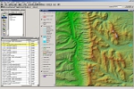
Now, with more advanced computer technology, map data, vector, and raster can be collected, layered, and stored digitally. Data is recalled by layer, as needed, to create map overlays or thematic maps. With GIS technology, attribute data – such as addressing, ownership, soil classifications, utilities, traffic patterns, social, and economic – as well as other non-graphical information, is stored in a database and then linked to graphical map data.
Geographic Information Systems (GIS) can perform queries of graphic and attribute databases and then output data to a computer screen or plotting device. The results can be stored, creating new data layers in the system. Data may also be shared among multiple users and different agencies via Internet and Intranet connections. Mobile units, including police, fire, and ambulance, can use the data in the field.
Aerial Data Service provides ground control networks and digital photogrammetric base mapping for the implementation of GIS data.